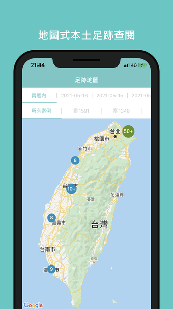
疫圖 - Your Lifesaver Map During the Pandemic
疫圖 is a free iPhone application developed by MyTime Co. Ltd. in the Utilities & Tools category. It is designed to help users track the footprints of confirmed COVID-19 cases in their local area. By utilizing an intuitive map interface, users can easily understand the situation of infection hotspots and avoid unnecessary gatherings in those areas.
By becoming a member of 疫圖 and setting their location, users will receive real-time epidemic prevention information proactively. This app aims to contribute to Taiwan's efforts in fighting against the ongoing pandemic and ensuring the safety of its citizens.
Please note that the local footprint information provided in 疫圖 is sourced from the central and local governments. It is intended for reference purposes only, and users are advised to consult official information if they have any doubts. In case of any inaccuracies in the footprint information, members can utilize the error reporting feature after logging in to assist in the correction process.